Bench mark and bolt on St Paul's church, Macclesfield
Introduction
The photograph on this page of Bench mark and bolt on St Paul's church, Macclesfield by John S Turner as part of the Geograph project.
The Geograph project started in 2005 with the aim of publishing, organising and preserving representative images for every square kilometre of Great Britain, Ireland and the Isle of Man.

There are currently over 7.5m images from over 14,400 individuals and you can help contribute to the project by visiting https://www.geograph.org.uk
Bench mark and bolt on St Paul's church, Macclesfield
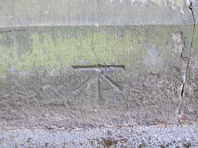
Image: © John S Turner Taken: 20 Jun 2013
This early Ordnance Survey bench mark and bolt is on the north face of the tower of St Paul's church. For details of the mark see: http://www.bench-marks.org.uk/bm36853
Images are licensed for reuse under creativecommons.org/licenses/by-sa/2.0
Image Location
Latitude
53.257275
Longitude
-2.119877