Stone of Mannan
Introduction
The photograph on this page of Stone of Mannan by kim traynor as part of the Geograph project.
The Geograph project started in 2005 with the aim of publishing, organising and preserving representative images for every square kilometre of Great Britain, Ireland and the Isle of Man.

There are currently over 7.5m images from over 14,400 individuals and you can help contribute to the project by visiting https://www.geograph.org.uk
Stone of Mannan
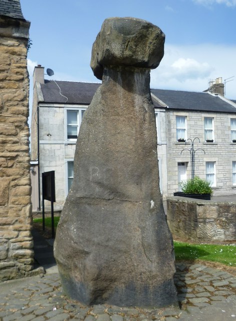
Image: © kim traynor Taken: 20 Jun 2013
A plaque on the adjacent tolbooth explains that the town takes its name from the ancient boulder known as the "clog" of "Mannan", from "Manau" a Celtic sea deity. It was originally located south of the town close to the shore of the River Forth before being removed to Clackmannan Tower. In 1833 the Bruce family had it raised onto the large stone block, dragged from the Abbey Craig at Stirling by a team of 16 horses.
Images are licensed for reuse under creativecommons.org/licenses/by-sa/2.0
Image Location
Latitude
56.10732
Longitude
-3.752423