River gauging station
Introduction
The photograph on this page of River gauging station by Richard Dorrell as part of the Geograph project.
The Geograph project started in 2005 with the aim of publishing, organising and preserving representative images for every square kilometre of Great Britain, Ireland and the Isle of Man.

There are currently over 7.5m images from over 14,400 individuals and you can help contribute to the project by visiting https://www.geograph.org.uk
River gauging station
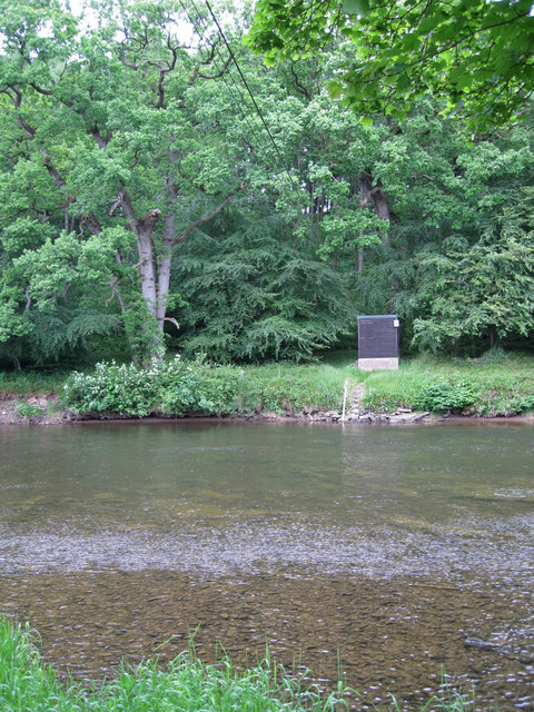
Image: © Richard Dorrell Taken: 14 Jun 2013
A small wooden shed stands on the far bank of the River Annan. Between it and the bank on which the photographer is standing, cables are stretched across the river and connected to a steel post (unseen in this image). The installation is marked by the Ordnance Survey as a River gauging station.
Images are licensed for reuse under creativecommons.org/licenses/by-sa/2.0
Image Location


Leaflet Map data © OpenStreetMap
Latitude
55.021433
Longitude
-3.267985