
Bridge Out on the Cefnbrynbrain cyclepath
Introduction
The photograph on this page of Bridge Out on the Cefnbrynbrain cyclepath by Nigel Davies as part of the Geograph project.
The Geograph project started in 2005 with the aim of publishing, organising and preserving representative images for every square kilometre of Great Britain, Ireland and the Isle of Man.

There are currently over 7.5m images from over 14,400 individuals and you can help contribute to the project by visiting https://www.geograph.org.uk
Bridge Out on the Cefnbrynbrain cyclepath
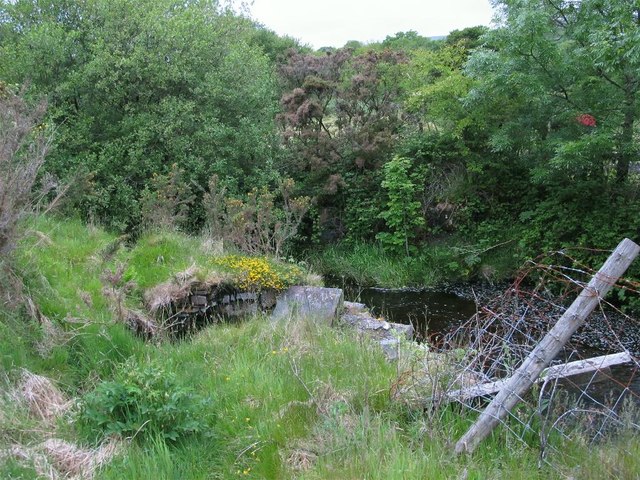
Image: © Nigel Davies Taken: 15 Jun 2013
This cyclepath starts well enough at a roadside siding in Cefnbrynbrain but the dismantled railway it is built on is sadly lacking its original bridge to cross the river Amman here at Rhosaman. This necessitates an escape down a public footpath that emerges next to the Rose & Crown Image The cycleway has since been extended and a new bridge built. See Image
Images are licensed for reuse under creativecommons.org/licenses/by-sa/2.0
Image Location

Latitude
51.809363
Longitude
-3.843123