Bridport from the east
Introduction
The photograph on this page of Bridport from the east by John Stephen as part of the Geograph project.
The Geograph project started in 2005 with the aim of publishing, organising and preserving representative images for every square kilometre of Great Britain, Ireland and the Isle of Man.

There are currently over 7.5m images from over 14,400 individuals and you can help contribute to the project by visiting https://www.geograph.org.uk
Bridport from the east
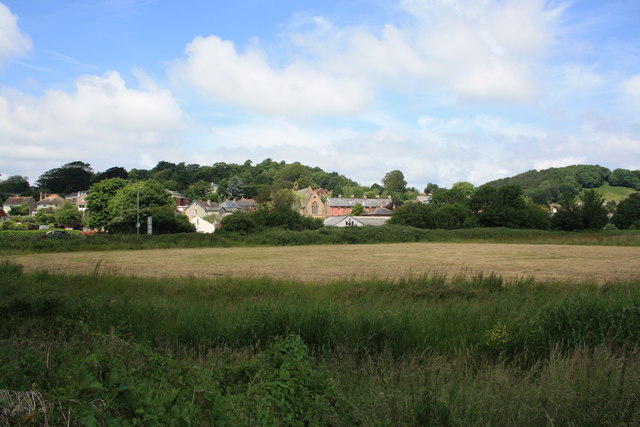
Image: © John Stephen Taken: 28 Jun 2013
View of Bridport from the east behind the A35. The point of view is in SY4792 on the east bank of the River Asker, the buildings and Sea Road North (the A3066 to Beaminster) are in SY4793. The low buildings in the middle distance are on the Old Laundry industrial estate on the west side of Sea Road North (which runs left to right). In the centre is the rear of St Andrew's Church, which fronts onto on St Andrews Road. Coneygar Hill is on the left and Watton Hill on the right.
Images are licensed for reuse under creativecommons.org/licenses/by-sa/2.0
Image Location
Latitude
50.735098
Longitude
-2.749983