Hadrian's Wall: Denton Burn
Introduction
The photograph on this page of Hadrian's Wall: Denton Burn by Anthony Foster as part of the Geograph project.
The Geograph project started in 2005 with the aim of publishing, organising and preserving representative images for every square kilometre of Great Britain, Ireland and the Isle of Man.

There are currently over 7.5m images from over 14,400 individuals and you can help contribute to the project by visiting https://www.geograph.org.uk
Hadrian's Wall: Denton Burn
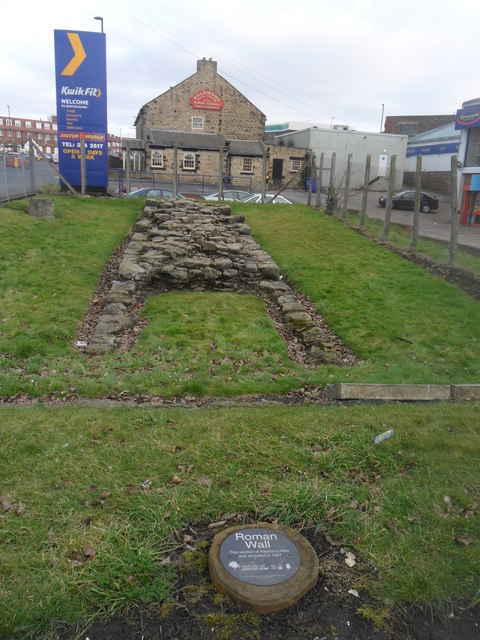
Image: © Anthony Foster Taken: 1 Mar 2013
The plaque in the foreground states that this section of wall was revealed in 1927. In the background is Solomons Indian Restaurant: The building used to be the farmhouse of Thorntree Farm
Images are licensed for reuse under creativecommons.org/licenses/by-sa/2.0
Image Location
Latitude
54.982796
Longitude
-1.686208