Inverted benchmark on bungalow on E side of B6160
Introduction
The photograph on this page of Inverted benchmark on bungalow on E side of B6160 by Roger Templeman as part of the Geograph project.
The Geograph project started in 2005 with the aim of publishing, organising and preserving representative images for every square kilometre of Great Britain, Ireland and the Isle of Man.

There are currently over 7.5m images from over 14,400 individuals and you can help contribute to the project by visiting https://www.geograph.org.uk
Inverted benchmark on bungalow on E side of B6160
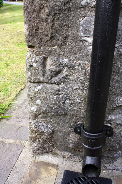
Image: © Roger Templeman Taken: 18 Jun 2013
Ordnance Survey cut mark benchmark described on the Bench Mark Database at http://www.bench-marks.org.uk/bm49070. The stone with the mark was probably turned upside down when the building was rebuilt during conversion from brewhouse for the pub opposite to the present bungalow
Images are licensed for reuse under creativecommons.org/licenses/by-sa/2.0
Image Location
Latitude
54.105988
Longitude
-2.039882