Millbrook Cross
Introduction
The photograph on this page of Millbrook Cross by Derek Harper as part of the Geograph project.
The Geograph project started in 2005 with the aim of publishing, organising and preserving representative images for every square kilometre of Great Britain, Ireland and the Isle of Man.

There are currently over 7.5m images from over 14,400 individuals and you can help contribute to the project by visiting https://www.geograph.org.uk
Millbrook Cross
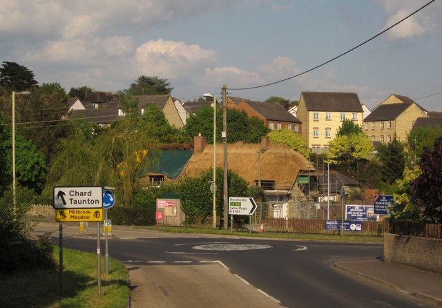
Image: © Derek Harper Taken: 25 May 2013
The junction northeast of Axminster, seen from the A358 Chard Road. Being re-thatched is the C18 Millbrook Farm http://list.english-heritage.org.uk/resultsingle.aspx?uid=1333493&searchtype=mapsearch . Behind it is the new housing development at Millbrook Meadows.
Images are licensed for reuse under creativecommons.org/licenses/by-sa/2.0
Image Location
Latitude
50.784554
Longitude
-2.991502