The island, Penn Fields
Introduction
The photograph on this page of The island, Penn Fields by Richard Vince as part of the Geograph project.
The Geograph project started in 2005 with the aim of publishing, organising and preserving representative images for every square kilometre of Great Britain, Ireland and the Isle of Man.

There are currently over 7.5m images from over 14,400 individuals and you can help contribute to the project by visiting https://www.geograph.org.uk
The island, Penn Fields
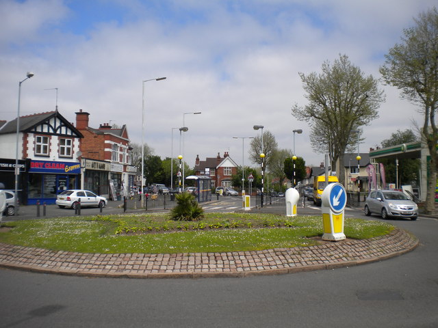
Image: © Richard Vince Taken: 6 Jun 2013
When I was at junior school, this roundabout was always referred to simply as "the island", which was sufficient as such things are rare in Penn Fields. It is at the south end of Lea Road (centre), where that thoroughfare meets the B4161 (Stubbs Road to the east, Birches Barn Road to the west). Wolverhampton Corporation trolleybus (motorbus from 1963) route 4, from the town centre via Lea Road, turned in this junction. The present bus route serving this area continues from here to Warstones estate; buses have not terminated here for many years. The shops here exist only on one side of the junction, the parade beginning on Birches Barn Road (out of frame to the left) and continuing a little way along Jeffcock Road (off Lea Road behind the bus shelter).
Images are licensed for reuse under creativecommons.org/licenses/by-sa/2.0
Image Location


Leaflet Map data © OpenStreetMap
Latitude
52.571363
Longitude
-2.145438