The Bluestane, Crail Parish Kirk
Introduction
The photograph on this page of The Bluestane, Crail Parish Kirk by kim traynor as part of the Geograph project.
The Geograph project started in 2005 with the aim of publishing, organising and preserving representative images for every square kilometre of Great Britain, Ireland and the Isle of Man.

There are currently over 7.5m images from over 14,400 individuals and you can help contribute to the project by visiting https://www.geograph.org.uk
The Bluestane, Crail Parish Kirk
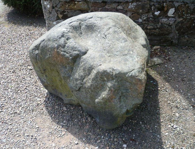
Image: © kim traynor Taken: 7 Jun 2013
Bluestone boulder at the entrance to the parish kirk, said to have been thrown by the De'il all the war from the Isle of May at the mouth of the Forth to destroy the building of the church. The round indentation is reputedly Auld Nick's thumbprint.
Images are licensed for reuse under creativecommons.org/licenses/by-sa/2.0
Image Location
Latitude
56.262196
Longitude
-2.625035