Former Mount Pleasant Inn, Cwmtillery
Introduction
The photograph on this page of Former Mount Pleasant Inn, Cwmtillery by Jaggery as part of the Geograph project.
The Geograph project started in 2005 with the aim of publishing, organising and preserving representative images for every square kilometre of Great Britain, Ireland and the Isle of Man.

There are currently over 7.5m images from over 14,400 individuals and you can help contribute to the project by visiting https://www.geograph.org.uk
Former Mount Pleasant Inn, Cwmtillery
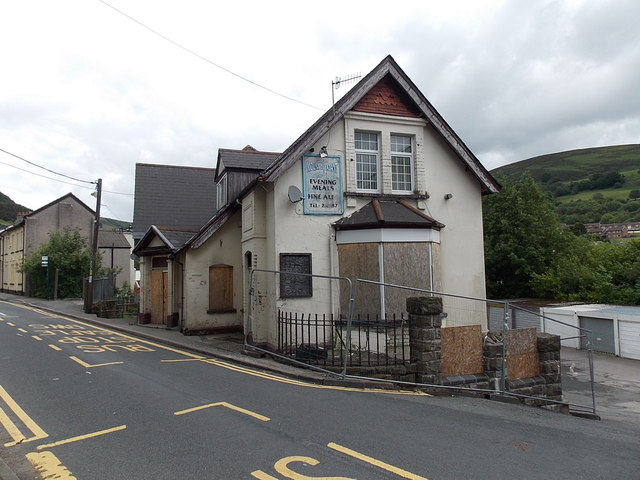
Image: © Jaggery Taken: 24 Jun 2013
Viewed across Alma Street. The former inn is boarded up and fenced off. A notice on the fence shows that Citi Groups Estates Ltd have applied to Blaenau Gwent County Borough Council for planning permission for change of use from public house to four residential units.
Images are licensed for reuse under creativecommons.org/licenses/by-sa/2.0
Image Location
Latitude
51.736316
Longitude
-3.136452