Holderness Road, Kingston upon Hull
Introduction
The photograph on this page of Holderness Road, Kingston upon Hull by Bernard Sharp as part of the Geograph project.
The Geograph project started in 2005 with the aim of publishing, organising and preserving representative images for every square kilometre of Great Britain, Ireland and the Isle of Man.

There are currently over 7.5m images from over 14,400 individuals and you can help contribute to the project by visiting https://www.geograph.org.uk
Holderness Road, Kingston upon Hull
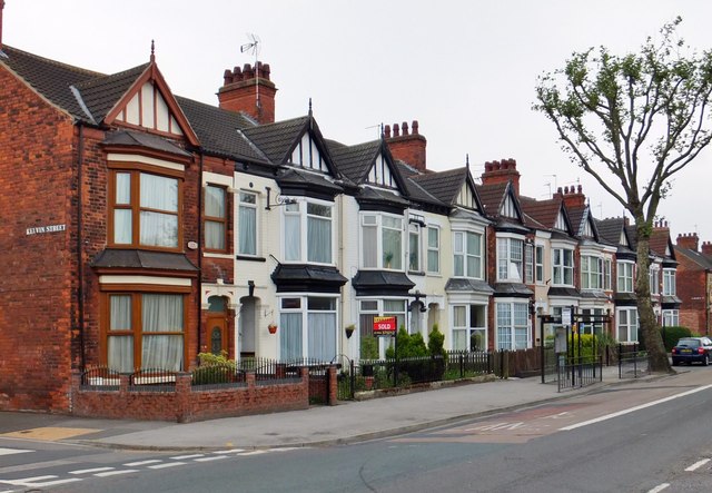
Image: © Bernard Sharp Taken: 19 Jun 2013
Between Kelvin Street and Faraday Street, Nos.572 to 554 Holderness Road, an Edwardian terrace of ten, still in residential use. Half-timbered cross-gable roofs with pointed wooden finials and stepped two-storey front bays with lead roofs.
Images are licensed for reuse under creativecommons.org/licenses/by-sa/2.0
Image Location
Latitude
53.761834
Longitude
-0.299018