Site of Fordingbridge station, 1992
Introduction
The photograph on this page of Site of Fordingbridge station, 1992 by Ben Brooksbank as part of the Geograph project.
The Geograph project started in 2005 with the aim of publishing, organising and preserving representative images for every square kilometre of Great Britain, Ireland and the Isle of Man.

There are currently over 7.5m images from over 14,400 individuals and you can help contribute to the project by visiting https://www.geograph.org.uk
Site of Fordingbridge station, 1992
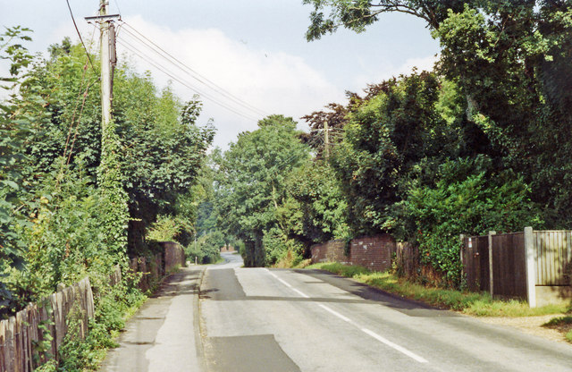
Image: © Ben Brooksbank Taken: 14 Aug 1992
View NW on B3078 Cadnam - Fordingbridge - Cranborne road, the station having been below on the left: ex-LSW Salisbury (to the right) - West Moors - Wimborne - Broadstone (- Poole - Bournemouth) line. The station and the useful line Salisbury (Alderbury Junction) - West Moors closed completely from 4/5/64.
Images are licensed for reuse under creativecommons.org/licenses/by-sa/2.0
Image Location
Latitude
50.928893
Longitude
-1.807288