
Crosfield Bridge, Lymm Dam
Introduction
The photograph on this page of Crosfield Bridge, Lymm Dam by David Dixon as part of the Geograph project.
The Geograph project started in 2005 with the aim of publishing, organising and preserving representative images for every square kilometre of Great Britain, Ireland and the Isle of Man.

There are currently over 7.5m images from over 14,400 individuals and you can help contribute to the project by visiting https://www.geograph.org.uk
Crosfield Bridge, Lymm Dam
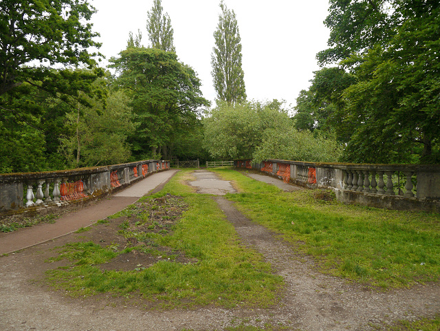
Image: © David Dixon Taken: 16 Jun 2013
William Lever bought the Beechwood Estate at the beginning of the twentieth century, intending to make considerable changes to the area and develop the site into housing for his workers. His proposed development was based around three roads which would meet at the bridge. The bridge was constructed just after the First World War but the houses were never built, Lever left Beechwood and the house was demolished in the 1930s. The estate was divided and the section which is now Lymm Dam eventually passed into local authority ownership, remaining so to this day. Because Lever’s vision was unrealised, Crosfield Bridge has never been required to carry regular vehicular traffic and, as a result, very little maintenance work has been carried out, The bridge has stood for ninety years and has fallen into a state of considerable disrepair. The obvious deterioration which can be seen in this photograph of the bridge deck runs throughout the structure.
Images are licensed for reuse under creativecommons.org/licenses/by-sa/2.0
Image Location

Latitude
53.371944
Longitude
-2.484976