Roman Aqueduct, near Poundbury Hill fort
Introduction
The photograph on this page of Roman Aqueduct, near Poundbury Hill fort by Ian Andrews as part of the Geograph project.
The Geograph project started in 2005 with the aim of publishing, organising and preserving representative images for every square kilometre of Great Britain, Ireland and the Isle of Man.

There are currently over 7.5m images from over 14,400 individuals and you can help contribute to the project by visiting https://www.geograph.org.uk
Roman Aqueduct, near Poundbury Hill fort
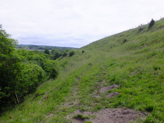
Image: © Ian Andrews Taken: 21 Jun 2013
Although the aqueduct followed the course of the River Frome, it had to follow an almost level course (rising at 275ft and arriving in Dorchester at 260ft) and so had to run into the smaller "spur" valleys of the Frome. Here at Fordington Bottom the aqueduct does just that and runs up the spur valley for almost half a mile before making a "U" turn and heading back down the other side of the spur.
Images are licensed for reuse under creativecommons.org/licenses/by-sa/2.0
Image Location
Latitude
50.72149
Longitude
-2.461481