Wycombe Marsh Brook: Former Beech Road ford
Introduction
The photograph on this page of Wycombe Marsh Brook: Former Beech Road ford by Nigel Cox as part of the Geograph project.
The Geograph project started in 2005 with the aim of publishing, organising and preserving representative images for every square kilometre of Great Britain, Ireland and the Isle of Man.

There are currently over 7.5m images from over 14,400 individuals and you can help contribute to the project by visiting https://www.geograph.org.uk
Wycombe Marsh Brook: Former Beech Road ford
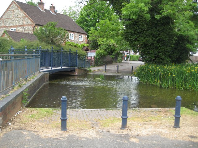
Image: © Nigel Cox Taken: 5 Jun 2012
The watercourse that the ford used to cross here is actually a braid of the main River Wye known as the Back Stream or Wycombe Marsh Brook. There used to be a paper mill just upstream of the ford here, known as Beech Mill, hence the probable origin of the road name.
Images are licensed for reuse under creativecommons.org/licenses/by-sa/2.0
Image Location
Latitude
51.615866
Longitude
-0.718273