Bus turning circle, Wobaston
Introduction
The photograph on this page of Bus turning circle, Wobaston by Richard Vince as part of the Geograph project.
The Geograph project started in 2005 with the aim of publishing, organising and preserving representative images for every square kilometre of Great Britain, Ireland and the Isle of Man.

There are currently over 7.5m images from over 14,400 individuals and you can help contribute to the project by visiting https://www.geograph.org.uk
Bus turning circle, Wobaston
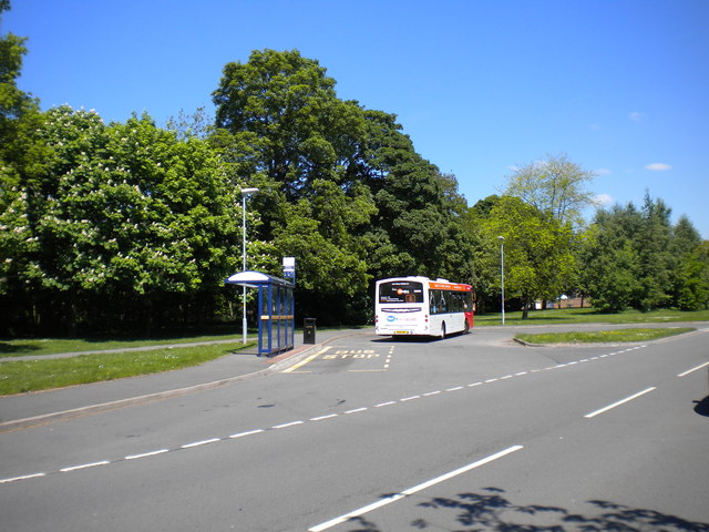
Image: © Richard Vince Taken: 4 Jun 2013
This turning circle, on Patshull Avenue, was constructed to allow buses serving this estate to turn; the buses approached from the south, so the turning circle was shaped accordingly. However, the only bus route that terminates here now, the 6 from Wolverhampton city centre via Whitmore Reans and Pendeford (one of which is visible in this picture), arrives from the north, and so the middle part of the turning circle (right) has been reshaped somewhat to enable the buses to enter it. The park on the left is bounded at its far end by the Staffordshire & Worcestershire Canal.
Images are licensed for reuse under creativecommons.org/licenses/by-sa/2.0
Image Location


Leaflet Map data © OpenStreetMap
Latitude
52.626932
Longitude
-2.134838