
Grove Wood, lower end, Westwood Farm near Harmans Cross
Introduction
The photograph on this page of Grove Wood, lower end, Westwood Farm near Harmans Cross by David Hodd as part of the Geograph project.
The Geograph project started in 2005 with the aim of publishing, organising and preserving representative images for every square kilometre of Great Britain, Ireland and the Isle of Man.

There are currently over 7.5m images from over 14,400 individuals and you can help contribute to the project by visiting https://www.geograph.org.uk
Grove Wood, lower end, Westwood Farm near Harmans Cross
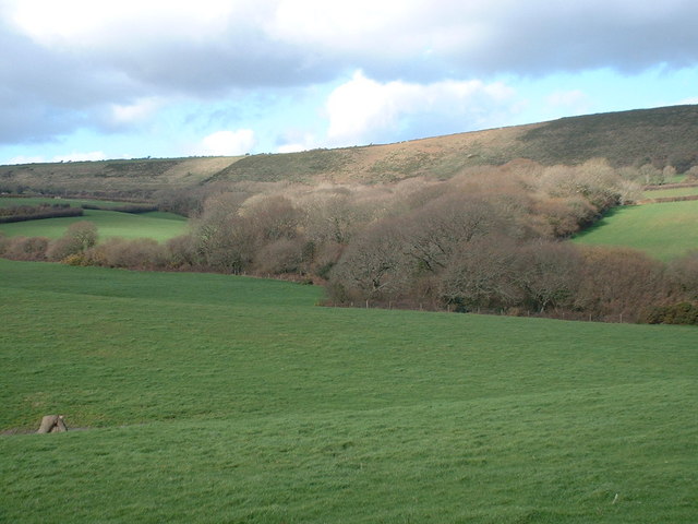
Image: © David Hodd Taken: 1 Mar 2007
The geology between Purbeck's chalk ridge and the Swanage road is a quick succession of the Wealden beds - gault clays, greensands, wealden clays. This, and the streams draining it leave a very convoluted landscape, and at this time of year, a wet one too. Grove wood is a mix of wet carr and hazel coppice with Bluebells which form the head of a river valley. It is the largest of such woods in the area. Here Grove Wood is backed by Ailwood Down, and is photographed from the triangular copse near the Westwood Farm path.
Images are licensed for reuse under creativecommons.org/licenses/by-sa/2.0
Image Location

Latitude
50.62708
Longitude
-2.014651