Dundee Law
Introduction
The photograph on this page of Dundee Law by Rude Health as part of the Geograph project.
The Geograph project started in 2005 with the aim of publishing, organising and preserving representative images for every square kilometre of Great Britain, Ireland and the Isle of Man.

There are currently over 7.5m images from over 14,400 individuals and you can help contribute to the project by visiting https://www.geograph.org.uk
Dundee Law
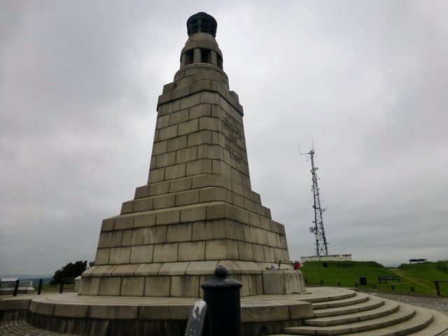
Image: © Rude Health Taken: 9 Jun 2013
A war memorial to the fallen in both world wars was constructed atop the summit. In the years 1992 to 1994 the facilities on the summit of the Law were upgraded by Dundee District Council and Scottish Enterprise Tayside with additional funding from the European Commission's regional development fund. The memorial is lit with a large flame at its top on a number of significant days, viz: the 25th September (in memory of the Battle of Loos - in which many members of the local Black Watch regiment lost their lives), 24 October (United Nations Day), 11 November (Armistice Day) and Remembrance Sunday. Archaeological evidence of burials suggest that the law may have been used by human settlers 3500 years ago. During the Iron Age it was the site of a Pictish settlement. Roman pottery has been found on the law, suggesting that the Romans may have used it as a lookout post in the first century. Name: Dundee Law Hill number: 104964 Height: 174m / 571ft Area: 26A: Central Scotland from Dumbarton to Montrose Class: 1 Grid ref: NO391313 (est) Drop: 78m Col: 96m
Images are licensed for reuse under creativecommons.org/licenses/by-sa/2.0
Image Location
Latitude
56.469599
Longitude
-2.990888