Municipal Buildings (detail)
Introduction
The photograph on this page of Municipal Buildings (detail) by Lairich Rig as part of the Geograph project.
The Geograph project started in 2005 with the aim of publishing, organising and preserving representative images for every square kilometre of Great Britain, Ireland and the Isle of Man.

There are currently over 7.5m images from over 14,400 individuals and you can help contribute to the project by visiting https://www.geograph.org.uk
Municipal Buildings (detail)
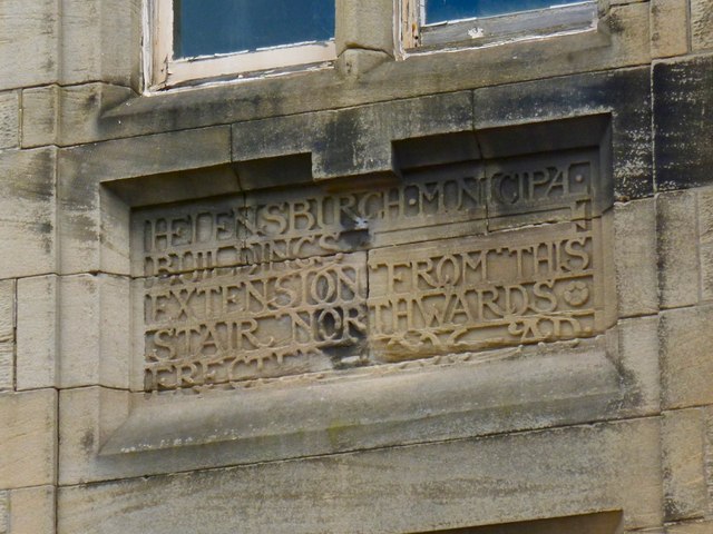
Image: © Lairich Rig Taken: 29 May 2013
This detail from the western side of the Image relates to an addition made by A N Paterson; see the link just given. "HELENSBURGH MUNICIPAL BUILDINGS EXTENSION FROM THIS STAIR NORTHWARDS ERECTED 1906 AD" See Image for the southern side of the buildings.
Images are licensed for reuse under creativecommons.org/licenses/by-sa/2.0
Image Location
Latitude
56.0042
Longitude
-4.733078