London LOOP at Elmbridge Meadows
Introduction
The photograph on this page of London LOOP at Elmbridge Meadows by Marathon as part of the Geograph project.
The Geograph project started in 2005 with the aim of publishing, organising and preserving representative images for every square kilometre of Great Britain, Ireland and the Isle of Man.

There are currently over 7.5m images from over 14,400 individuals and you can help contribute to the project by visiting https://www.geograph.org.uk
London LOOP at Elmbridge Meadows
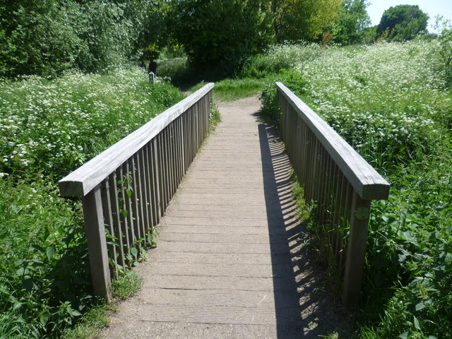
Image: © Marathon Taken: 5 Jun 2013
Maps of the 19th century show the Hogsmill Valley as a patchwork of fields, those close to the river being meadows whilst arable fields lay further away out of the reach of flooding. The Hogsmill is a chalk stream since most of its water comes from the dip-slope springs at Ewell. At the turn of the 20th century this was still a large area of farmland. It has been saved from development by virtue of being the floodplain of the Hogsmill. It now forms a wildlife corridor followed here through Elmbridge Meadows by the London LOOP on its way to Kingston Bridge. This is looking back upriver towards Old Malden. The footbridge crosses the Tolworth Brook which rises at Claygate. It joins the Hogsmill just to the left. Cow parsley was out in profusion either side of the path.
Images are licensed for reuse under creativecommons.org/licenses/by-sa/2.0
Image Location
Latitude
51.39637
Longitude
-0.276214