Loweswater from Waterend
Introduction
The photograph on this page of Loweswater from Waterend by Ben Brooksbank as part of the Geograph project.
The Geograph project started in 2005 with the aim of publishing, organising and preserving representative images for every square kilometre of Great Britain, Ireland and the Isle of Man.

There are currently over 7.5m images from over 14,400 individuals and you can help contribute to the project by visiting https://www.geograph.org.uk
Loweswater from Waterend
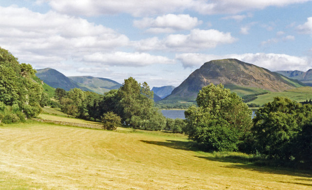
Image: © Ben Brooksbank Taken: 8 Jul 1986
View SE: nearest on the right are the Loweswater Fells (Mellbreak (1,668 ft.) prominent), Pillar (2,927 ft.) is in the distance; on the left are Brackenthwaite (2,317 ft.) and Grasmoor (2,742 ft.).
Images are licensed for reuse under creativecommons.org/licenses/by-sa/2.0
Image Location
Latitude
54.58978
Longitude
-3.366894