Elliot Street
Introduction
The photograph on this page of Elliot Street by Thomas Nugent as part of the Geograph project.
The Geograph project started in 2005 with the aim of publishing, organising and preserving representative images for every square kilometre of Great Britain, Ireland and the Isle of Man.

There are currently over 7.5m images from over 14,400 individuals and you can help contribute to the project by visiting https://www.geograph.org.uk
Elliot Street
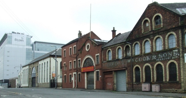
Image: © Thomas Nugent Taken: 19 May 2013
The building on the right has an interesting history. The name William Cook thrives today, based in Sheffield https://www.william-cook.co.uk/gb/heritage . A Category B Listed building, circa 1870 http://data.historic-scotland.gov.uk/pls/htmldb/f?p=2200:15:0::::BUILDING:33017 . The next building is the former Anderston Brass Foundry, also a Category B Listed building from circa 1870 http://data.historic-scotland.gov.uk/pls/htmldb/f?p=2200:15:0::::BUILDING:33018 . The white building is the former Cranstonhill Iron Foundry, also Category B Listed, circa 1854 http://data.historic-scotland.gov.uk/pls/htmldb/f?p=2200:15:0::::BUILDING:33019 .
Images are licensed for reuse under creativecommons.org/licenses/by-sa/2.0
Image Location
Latitude
55.862085
Longitude
-4.278938