Swansea Docks
Introduction
The photograph on this page of Swansea Docks by Kevin Corcoran as part of the Geograph project.
The Geograph project started in 2005 with the aim of publishing, organising and preserving representative images for every square kilometre of Great Britain, Ireland and the Isle of Man.

There are currently over 7.5m images from over 14,400 individuals and you can help contribute to the project by visiting https://www.geograph.org.uk
Swansea Docks
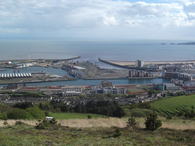
Image: © Kevin Corcoran Taken: 15 May 2013
This photo is taken from the top of Kilvey Hill and clearly shows the change of use of Swansea Docks. Once a thriving dock with ships arriving and departing from all over the world, many of the older buildings have now been cleared and are being replaced by non dock related commercial enterprises and residential buildings. The area has been made more marketable by the development of the Tawe Barrage.
Images are licensed for reuse under creativecommons.org/licenses/by-sa/2.0
Image Location
Latitude
51.614213
Longitude
-3.922735