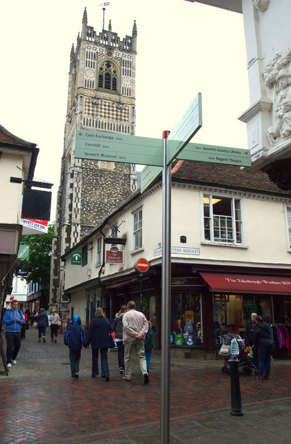
Ipswich IP1, Suffolk.
Introduction
The photograph on this page of Ipswich IP1, Suffolk. by David Hallam-Jones as part of the Geograph project.
The Geograph project started in 2005 with the aim of publishing, organising and preserving representative images for every square kilometre of Great Britain, Ireland and the Isle of Man.
There are currently over 7.5m images from over 14,400 individuals and you can help contribute to the project by visiting https://www.geograph.org.uk

Image: © David Hallam-Jones Taken: 28 May 2013
A redundant church on Dial Lane seen from St Stephen’s Lane (behind the photographer in the main) at its junction with Buttermarket. St Lawrence’s church served as a parish church until the early 1970s, when was declared redundant by the diocese due to its falling membership. In 2008 it was reopened as a community restaurant and function venue under the auspices of the Ipswich Historic Churches Trust. The church tower houses the oldest ring of church bells in Christendom. Four of them were cast c.1450 and a fifth added c.1480. The bells remain undamaged and unmodified and still include their original clappers. In 1985 the bells were removed when the tower was declared unsafe but following the reconstruction of the tower and the installation of a new bell frame, the bells, having been overhauled by the Whitechapel Bell Foundry, were returned to working use in September 2009.

