Ventnor in 1953
Introduction
The photograph on this page of Ventnor in 1953 by Anthony Harrison as part of the Geograph project.
The Geograph project started in 2005 with the aim of publishing, organising and preserving representative images for every square kilometre of Great Britain, Ireland and the Isle of Man.

There are currently over 7.5m images from over 14,400 individuals and you can help contribute to the project by visiting https://www.geograph.org.uk
Ventnor in 1953
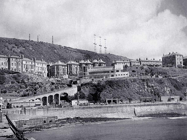
Image: © Anthony Harrison Taken: Unknown
A view of the East front of Ventnor taken from the pier in 1953 when the wartime "Chain Home" radar aerials were still in existence.
Images are licensed for reuse under creativecommons.org/licenses/by-sa/2.0
Image Location
Latitude
50.594867
Longitude
-1.203966