Jubilee Bridge
Introduction
The photograph on this page of Jubilee Bridge by Anne Burgess as part of the Geograph project.
The Geograph project started in 2005 with the aim of publishing, organising and preserving representative images for every square kilometre of Great Britain, Ireland and the Isle of Man.

There are currently over 7.5m images from over 14,400 individuals and you can help contribute to the project by visiting https://www.geograph.org.uk
Jubilee Bridge
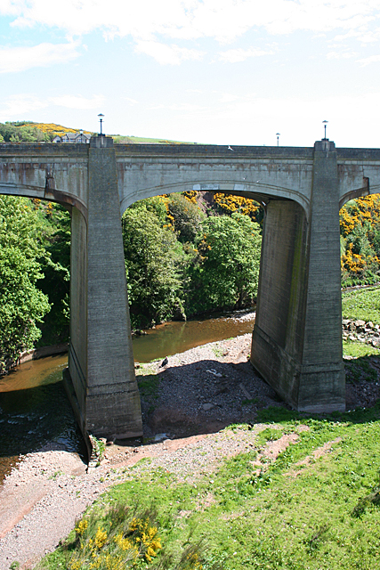
Image: © Anne Burgess Taken: 1 Jun 2013
This bridge was opened in 1935, and carries the A92, formerly the trunk road, across the Bervie Water, replacing the older bridge on 1799 from which this view is taken.
Images are licensed for reuse under creativecommons.org/licenses/by-sa/2.0
Image Location
Latitude
56.847238
Longitude
-2.277366