Bourtree Bush
Introduction
The photograph on this page of Bourtree Bush by Anne Burgess as part of the Geograph project.
The Geograph project started in 2005 with the aim of publishing, organising and preserving representative images for every square kilometre of Great Britain, Ireland and the Isle of Man.

There are currently over 7.5m images from over 14,400 individuals and you can help contribute to the project by visiting https://www.geograph.org.uk
Bourtree Bush
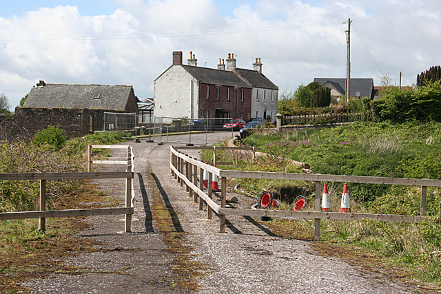
Image: © Anne Burgess Taken: 1 Jun 2013
This hamlet is named simply as Bush on the modern maps, and on its signpost, but the mid-Victorian six-inch Ordnance Survey map calls it Bourtree Bush. The three nearest houses are the oldest remaining ones. In the foreground is the former main road, but the bridge over the Den of Lauriston has collapsed on both sides. Even the fenced pedestrian path is now closed off at both ends; the barriers are just this side of the nearest building.
Images are licensed for reuse under creativecommons.org/licenses/by-sa/2.0
Image Location
Latitude
56.78405
Longitude
-2.390482