Former Powis Church
Introduction
The photograph on this page of Former Powis Church by Bill Harrison as part of the Geograph project.
The Geograph project started in 2005 with the aim of publishing, organising and preserving representative images for every square kilometre of Great Britain, Ireland and the Isle of Man.

There are currently over 7.5m images from over 14,400 individuals and you can help contribute to the project by visiting https://www.geograph.org.uk
Former Powis Church
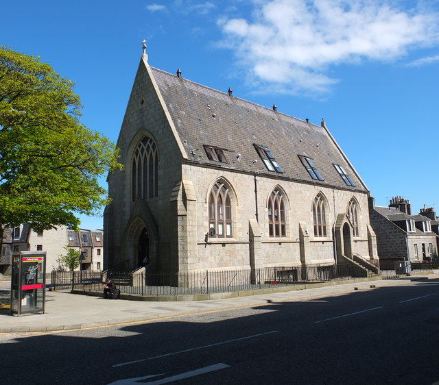
Image: © Bill Harrison Taken: 26 May 2013
Built 1895 at the converging junction of George Street and Causewayend as a chapel of ease for Old Machar Cathedral (St Machar's Cathedral) and elevated to full-parish status by the Court of Teinds (Tithes) in 1904. In its heyday it facilitated "aggressive evangelism" and open-air services in the surrounding working-class slums, now long demolished. Now converted to flats. See http://canmore.rcahms.gov.uk/en/site/178874/details/aberdeen+george+street+powis+parish+church/
Images are licensed for reuse under creativecommons.org/licenses/by-sa/2.0
Image Location
Latitude
57.157689
Longitude
-2.110079