Downtown Durness, 1986
Introduction
The photograph on this page of Downtown Durness, 1986 by Ben Brooksbank as part of the Geograph project.
The Geograph project started in 2005 with the aim of publishing, organising and preserving representative images for every square kilometre of Great Britain, Ireland and the Isle of Man.

There are currently over 7.5m images from over 14,400 individuals and you can help contribute to the project by visiting https://www.geograph.org.uk
Downtown Durness, 1986
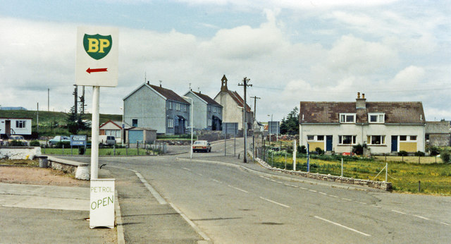
Image: © Ben Brooksbank Taken: 3 Jul 1986
View westward, where the A836 across the Far North of Scotland has to turn back southward, as there is no road on the final 10-15 miles to Cape Wrath. Durness seems far more remote than John o'Groats. (Cf. Image]) for changes since 1986.
Images are licensed for reuse under creativecommons.org/licenses/by-sa/2.0
Image Location
Latitude
58.568458
Longitude
-4.746674