Southwell NG25, Notts.
Introduction
The photograph on this page of Southwell NG25, Notts. by David Hallam-Jones as part of the Geograph project.
The Geograph project started in 2005 with the aim of publishing, organising and preserving representative images for every square kilometre of Great Britain, Ireland and the Isle of Man.

There are currently over 7.5m images from over 14,400 individuals and you can help contribute to the project by visiting https://www.geograph.org.uk
Southwell NG25, Notts.
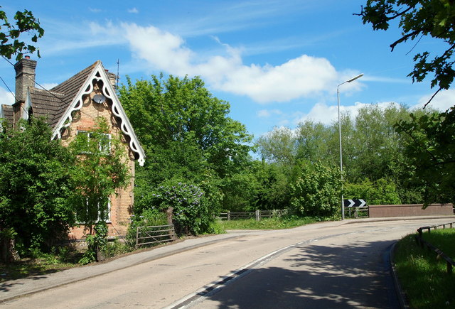
Image: © David Hallam-Jones Taken: 25 May 2013
An access gate into the Southwell Community Orchard and also onto a footpath that forms part of several trails, including the Easthorpe trail, the Bramley Apple trail and the Southwell trail. The gate lies between this private house and Greet Bridge (that carries the road over the River Greet) alongside Upton Road (the A612 Southwell-Upton road); the centre of Southwell being to the left. Apparently this property was a level crossing gate-keeper’s cottage. A short branch line was opened from Rolleston Junction to Southwell in 1847. This was also connected by the Midland Railway Company to a line from Mansfield. However, the stretch between Southwell and Mansfield was closed to passengers in 1929 leaving a short branch from Rolleston until closure in 1959. See also SK7154 : Gate Cottage.
Images are licensed for reuse under creativecommons.org/licenses/by-sa/2.0
Image Location
Latitude
53.079053
Longitude
-0.941273