Acres Road
Introduction
The photograph on this page of Acres Road by Alan Walker as part of the Geograph project.
The Geograph project started in 2005 with the aim of publishing, organising and preserving representative images for every square kilometre of Great Britain, Ireland and the Isle of Man.

There are currently over 7.5m images from over 14,400 individuals and you can help contribute to the project by visiting https://www.geograph.org.uk
Acres Road
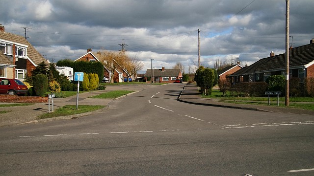
Image: © Alan Walker Taken: 26 Feb 2007
Acres Road from its junction with Rupert Street. The road is a cul-de-sac and is shaped a little like the letter ‘T’ the horizontal stroke of which, in this photograph, is ahead (in a north-easterly direction) in front of the facing bungalow. The ‘horizontal stroke’ of the ‘T’ is very lopsided: the left (northerly) side being longer than that of the right. Some 40metres into the road, on the left, can be seen the junction with Image and some 30metres beyond that on the right (and barely visible in this photograph) is the junction with Image To see a photograph from the other end of Acres Road but looking back, toward this viewpoint, click here Image To see a photograph of the 'horizontal stroke' section of the 'T', click here Image To the left of the Image Rupert Street continues northward toward Parkhouse Green. To the right Image continues southward toward its junction with Image
Images are licensed for reuse under creativecommons.org/licenses/by-sa/2.0
Image Location


Leaflet Map data © OpenStreetMap
Latitude
53.165533
Longitude
-1.373829