Southwell, NG25, Notts.
Introduction
The photograph on this page of Southwell, NG25, Notts. by David Hallam-Jones as part of the Geograph project.
The Geograph project started in 2005 with the aim of publishing, organising and preserving representative images for every square kilometre of Great Britain, Ireland and the Isle of Man.

There are currently over 7.5m images from over 14,400 individuals and you can help contribute to the project by visiting https://www.geograph.org.uk
Southwell, NG25, Notts.
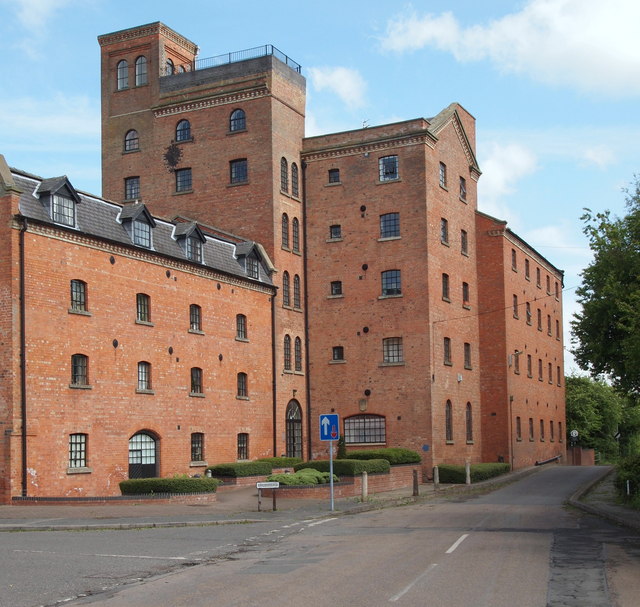
Image: © David Hallam-Jones Taken: 25 May 2013
An oft-photographed site on Normanton Road. The former Caudwell flour Mill on the south bank of the River Greet was built over the site of the medieval Burgage mill, a site purchased by Charles Caudwell in 1851. It seems that the mill was damaged by fires in 1867, 1893 and 1917 but that on each occasion it was rebuilt and the equipment upgraded. The Caudwell family were millers for four generations, after which Associated British Foods bought the mill. It closed in 1977 and was turned into flats in 1989. It is situated on the River Greet and located at the side of the Southwell Trail, a former railway route between Farnsfield and Rolleston Junction.
Images are licensed for reuse under creativecommons.org/licenses/by-sa/2.0
Image Location
Latitude
53.082335
Longitude
-0.946417