Maythorne, Southwell, Notts.
Introduction
The photograph on this page of Maythorne, Southwell, Notts. by David Hallam-Jones as part of the Geograph project.
The Geograph project started in 2005 with the aim of publishing, organising and preserving representative images for every square kilometre of Great Britain, Ireland and the Isle of Man.

There are currently over 7.5m images from over 14,400 individuals and you can help contribute to the project by visiting https://www.geograph.org.uk
Maythorne, Southwell, Notts.
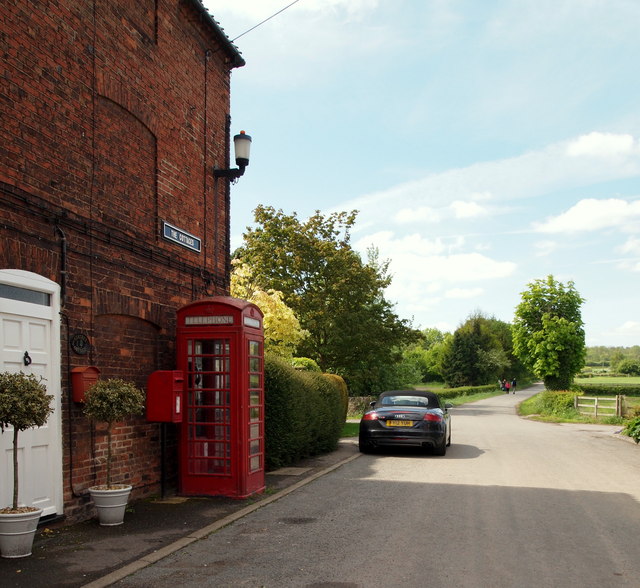
Image: © David Hallam-Jones Taken: 25 May 2013
A former worker's cottage at the entrance (or exit) to the former mill hamlet of Maythorne. This is Maythorne Lane and the walkers in the distance may be heading for a nearby access point onto the Southwell Trail, i.e. the trail that follows the railway track bed along the former train route between Farnsfield and Rolleston Junction. Maythorne Lane is a cul-de-sac with the River Greet behind the photographer and Lower Kirklington Road 5 minutes away in the distance.
Images are licensed for reuse under creativecommons.org/licenses/by-sa/2.0
Image Location
Latitude
53.092712
Longitude
-0.961097