Bobbers Mill: Ascot Road as it was
Introduction
The photograph on this page of Bobbers Mill: Ascot Road as it was by John Sutton as part of the Geograph project.
The Geograph project started in 2005 with the aim of publishing, organising and preserving representative images for every square kilometre of Great Britain, Ireland and the Isle of Man.

There are currently over 7.5m images from over 14,400 individuals and you can help contribute to the project by visiting https://www.geograph.org.uk
Bobbers Mill: Ascot Road as it was
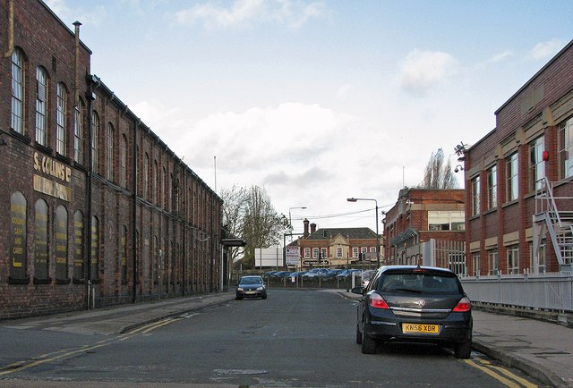
Image: © John Sutton Taken: 20 Nov 2009
This fairly dull 2009 picture has acquired some small historical value since Ascot Works - on the right - was demolished in May 2013. Collins Cash & Carry occupies the former factory building on the left. Alan Murray-Rust's Image] shows Ascot Works from Bobbers Mill Bridge; my Image] and Image] show the site after demolition. The Wheatsheaf, straight ahead on the corner of Nuthall Road and Aspley Lane, has closed since this photograph was taken.
Images are licensed for reuse under creativecommons.org/licenses/by-sa/2.0
Image Location
Latitude
52.966621
Longitude
-1.184188