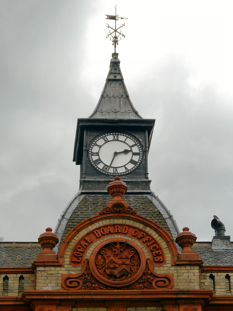
Withington Town Hall (detail)
Introduction
The photograph on this page of Withington Town Hall (detail) by David Dixon as part of the Geograph project.
The Geograph project started in 2005 with the aim of publishing, organising and preserving representative images for every square kilometre of Great Britain, Ireland and the Isle of Man.
There are currently over 7.5m images from over 14,400 individuals and you can help contribute to the project by visiting https://www.geograph.org.uk

Image: © David Dixon Taken: 23 May 2013
A closer view of Image The former Withington Town Hall, on Lapwing Lane, is designated by English Heritage as a Grade II listed building (http://www.britishlistedbuildings.co.uk/en-388262-former-withington-town-hall- British Listed Buildings). It was built, probably c.1880-90, as Local Board of Health offices and the listing text notes that it is a “Good example of modest late C19 civic building, representing an important phase in the development of local government” One of its most striking features is the pyramidal turret supporting a square clock with swept copper-clad fleche finished with a weathervane. Below the turret is a terracotta roundel with a shield and console supporters, under a semi-circular band with raised lettering "LOCAL BOARD OFFICES". Withington Local Board formed in 1876, became the Urban District Council 1894.

