Medieval map of Coventry
Introduction
The photograph on this page of Medieval map of Coventry by FCG as part of the Geograph project.
The Geograph project started in 2005 with the aim of publishing, organising and preserving representative images for every square kilometre of Great Britain, Ireland and the Isle of Man.

There are currently over 7.5m images from over 14,400 individuals and you can help contribute to the project by visiting https://www.geograph.org.uk
Medieval map of Coventry
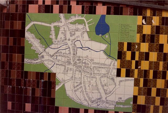
Image: © FCG Taken: Unknown
This ceramic tile representation of John Speed's 1610 'ground plott of Coventre' once decorated the wall of the ramp between the Lower and Upper Precincts. It has since been lost and, if the original was rectangular, part of it had already been lost by the time this photo was taken. It stood opposite a plan of the post-war redeveloped city ( Image ) which was removed to the other end of the Lower Precinct during redevelopment ca. 2000. The artist unsurprisingly chose not to retain the 69 point annotations on Speed's original and created an abbreviated set of 10 points: 1 Broadgate; 2 St Mary's Hall; 3 The Gates (separately annotated on the original); 4 Smithford Bridge; 5 Hill Street; 6 Cathedral (actually St Michael's church which wasn't a cathedral in 1610); 7 Much Park Street; 8 Swanswell Pool; 9 Greyfriar's Lane; 10 Bablake Church (St John's Church). Image shows the original ramp and the photographer's position is just upslope from the position of the murals.
Images are licensed for reuse under creativecommons.org/licenses/by-sa/2.0
Image Location


Leaflet Map data © OpenStreetMap
Latitude
52.408095
Longitude
-1.513674