Bulcote NG14, Notts.
Introduction
The photograph on this page of Bulcote NG14, Notts. by David Hallam-Jones as part of the Geograph project.
The Geograph project started in 2005 with the aim of publishing, organising and preserving representative images for every square kilometre of Great Britain, Ireland and the Isle of Man.

There are currently over 7.5m images from over 14,400 individuals and you can help contribute to the project by visiting https://www.geograph.org.uk
Bulcote NG14, Notts.
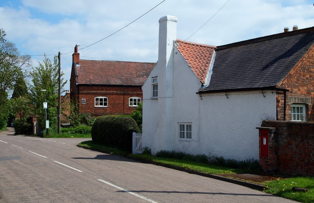
Image: © David Hallam-Jones Taken: 19 May 2013
All the roads that meet at this junction, including a section of it that bends round to the left (out of sight) are part of Old Main Road. The early C17th century property on the right is "Holly Nook" and once housed the solitary village shop. Next to the telegraph pole is "King's Barn", former early C18th farmhouse, that is currently empty and awaiting auction. Bulcote railway crossing, Bulcote Farm and the River Trent are accessed at this right-hand turning.
Images are licensed for reuse under creativecommons.org/licenses/by-sa/2.0
Image Location
Latitude
52.994242
Longitude
-1.020525