The Back Honoria Street bridge, Fartown cycleway, Huddersfield
Introduction
The photograph on this page of The Back Honoria Street bridge, Fartown cycleway, Huddersfield by Humphrey Bolton as part of the Geograph project.
The Geograph project started in 2005 with the aim of publishing, organising and preserving representative images for every square kilometre of Great Britain, Ireland and the Isle of Man.

There are currently over 7.5m images from over 14,400 individuals and you can help contribute to the project by visiting https://www.geograph.org.uk
The Back Honoria Street bridge, Fartown cycleway, Huddersfield
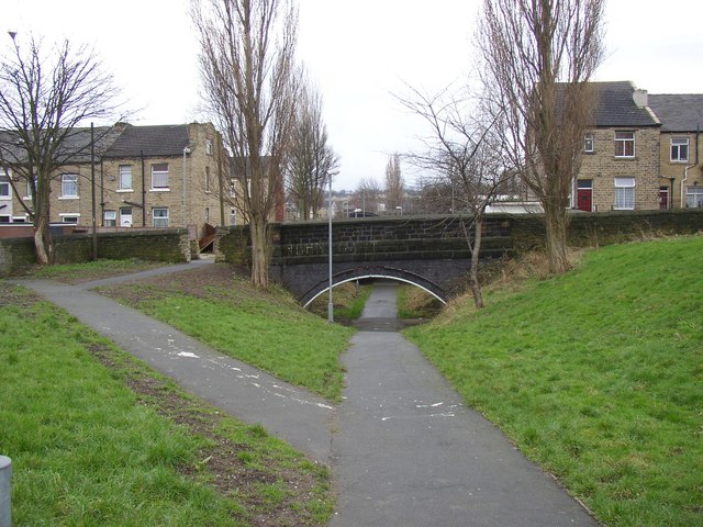
Image: © Humphrey Bolton Taken: 23 Feb 2007
The Honoria Street bridge, out of sight, is a girder bridge like the others, but for some reason this bridge is arched. This railway was constructed in the early 20C (it is not on the map of 1907) to give the Midland Railway Company an alternative route to London, rather than paying for running rights on the London and North West Railway line. They intended to build a terminal station at Newtown near St John's Road, but the First World War intervened and a goods yard was constructed instead, now redeveloped as a retail and business park. As with human redundancy, it was 'last in, first out'. Several houses had to be demolished to build the line across these streets.
Images are licensed for reuse under creativecommons.org/licenses/by-sa/2.0
Image Location
Latitude
53.659195
Longitude
-1.783577