Whitlees Bastle
Introduction
The photograph on this page of Whitlees Bastle by Mike Searle as part of the Geograph project.
The Geograph project started in 2005 with the aim of publishing, organising and preserving representative images for every square kilometre of Great Britain, Ireland and the Isle of Man.

There are currently over 7.5m images from over 14,400 individuals and you can help contribute to the project by visiting https://www.geograph.org.uk
Whitlees Bastle
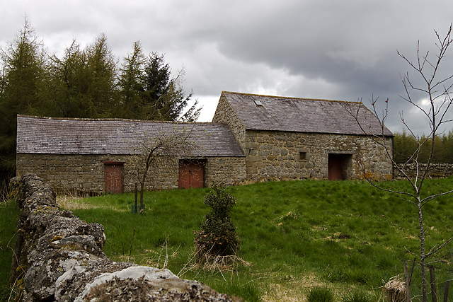
Image: © Mike Searle Taken: 16 May 2013
This appears to be a late C16 or early C17 strong house. It contains most of the features typical of a bastle, however, there is no barrel vault, and for this reason experts consider it not a true bastle.
Images are licensed for reuse under creativecommons.org/licenses/by-sa/2.0
Image Location
Latitude
55.22814
Longitude
-2.065215