Westhorpe, Southwell NG25, Notts.
Introduction
The photograph on this page of Westhorpe, Southwell NG25, Notts. by David Hallam-Jones as part of the Geograph project.
The Geograph project started in 2005 with the aim of publishing, organising and preserving representative images for every square kilometre of Great Britain, Ireland and the Isle of Man.

There are currently over 7.5m images from over 14,400 individuals and you can help contribute to the project by visiting https://www.geograph.org.uk
Westhorpe, Southwell NG25, Notts.
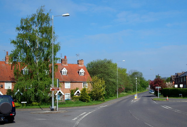
Image: © David Hallam-Jones Taken: 19 May 2013
Four roads converge here at the point formerly known as the Market Place. Vehicles on this, "the Oxton Road" (the B6386), can continue ahead and join the A6097 (the Epperstone By-Pass) a few miles ahead. The centre of Southwell lies a 4-5 minute drive away behind the photographer. The row of cottages behind the tall tree are all that remain of sixteen back-to-back properties that are said to have been used as dwellings and places of work by "stockingers" (stocking frame operators) during the late C16th.
Images are licensed for reuse under creativecommons.org/licenses/by-sa/2.0
Image Location
Latitude
53.075884
Longitude
-0.969413