Pirton Graveyard
Introduction
The photograph on this page of Pirton Graveyard by John Lucas as part of the Geograph project.
The Geograph project started in 2005 with the aim of publishing, organising and preserving representative images for every square kilometre of Great Britain, Ireland and the Isle of Man.

There are currently over 7.5m images from over 14,400 individuals and you can help contribute to the project by visiting https://www.geograph.org.uk
Pirton Graveyard
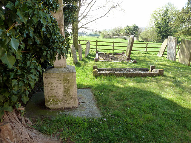
Image: © John Lucas Taken: 25 Apr 2013
On the left is the grave of the Revd. and Mrs. Loughborough. He was vicar of Pirton for 44 years until 1895. His wife organised a '20,000 shilling' fund for the restoration of the church in the 1870s when it was found to be in a parlous state and required extensive rebuilding. See also Image
Images are licensed for reuse under creativecommons.org/licenses/by-sa/2.0
Image Location


Leaflet Map data © OpenStreetMap
Latitude
51.971579
Longitude
-0.331242