St. Paul's vicarage
Introduction
The photograph on this page of St. Paul's vicarage by Jonathan Wilkins as part of the Geograph project.
The Geograph project started in 2005 with the aim of publishing, organising and preserving representative images for every square kilometre of Great Britain, Ireland and the Isle of Man.

There are currently over 7.5m images from over 14,400 individuals and you can help contribute to the project by visiting https://www.geograph.org.uk
St. Paul's vicarage
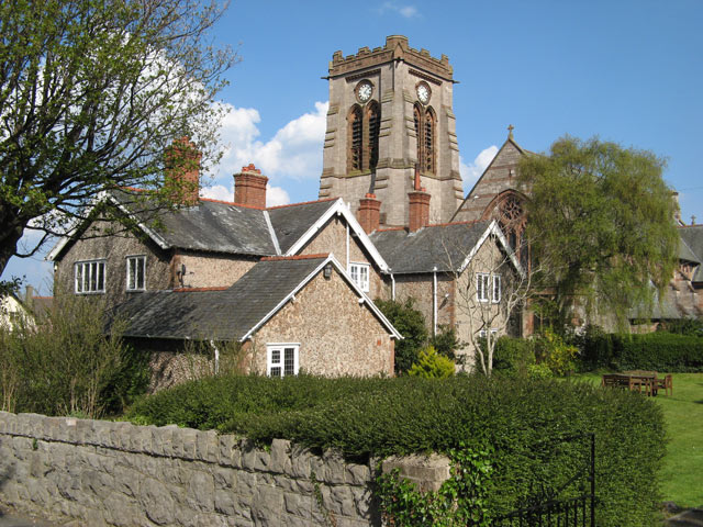
Image: © Jonathan Wilkins Taken: 7 May 2013
The west end of St. Paul's church with its tower and western rose window. The tower was not part of the original plan of the church by architect John Douglas, but was designed later and constructed after his death. Douglas was also responsible for the vicarage, seen here in rear view. The elevations between sandstone quoins are clad in a mosaic of small geometric pieces of limestone which gives a curious texture, not unlike the knapped flint walling of the southern chalk districts.
Images are licensed for reuse under creativecommons.org/licenses/by-sa/2.0
Image Location
Latitude
53.294083
Longitude
-3.727275