"Laverys", Lisburn (1)
Introduction
The photograph on this page of "Laverys", Lisburn (1) by Albert Bridge as part of the Geograph project.
The Geograph project started in 2005 with the aim of publishing, organising and preserving representative images for every square kilometre of Great Britain, Ireland and the Isle of Man.

There are currently over 7.5m images from over 14,400 individuals and you can help contribute to the project by visiting https://www.geograph.org.uk
"Laverys", Lisburn (1)
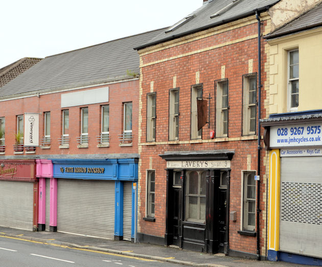
Image: © Albert Bridge Taken: 19 May 2013
A locally well-known bar at Chapel Hill. Listed http://www.doeni.gov.uk/niea/built/buildview?id=16054&js=true where the description includes “A mid-terrace two-storey-with-attic, three-bay former house built c.1800 and remodelled c.1870 into a public house”. Image shows the remodelling.
Images are licensed for reuse under creativecommons.org/licenses/by-sa/2.0
Image Location
Latitude
54.510717
Longitude
-6.049651