Barn at Edmundbyers
Introduction
The photograph on this page of Barn at Edmundbyers by Robert Graham as part of the Geograph project.
The Geograph project started in 2005 with the aim of publishing, organising and preserving representative images for every square kilometre of Great Britain, Ireland and the Isle of Man.

There are currently over 7.5m images from over 14,400 individuals and you can help contribute to the project by visiting https://www.geograph.org.uk
Barn at Edmundbyers
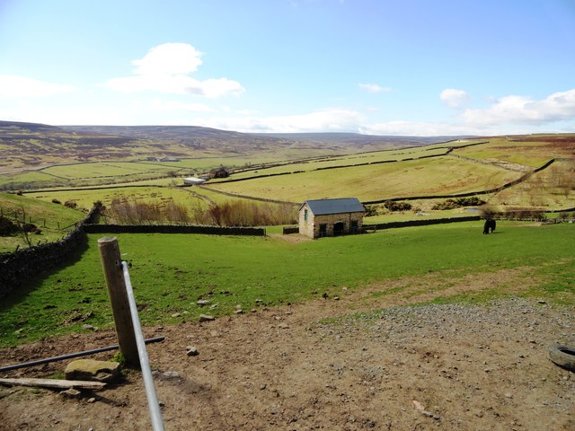
Image: © Robert Graham Taken: 1 May 2013
This barn lies to the west of the village, on the edge of the moors. It appears new or perhaps renovated in contrast to the majority of field barns in the uplands, and is obviously for the use of the horses. Beyond can be seen the farms of, firstly, Limerick Cottage, and secondly, Harehope Hall.
Images are licensed for reuse under creativecommons.org/licenses/by-sa/2.0
Image Location
Latitude
54.845619
Longitude
-1.986732