St. James's Church and trolley post
Introduction
The photograph on this page of St. James's Church and trolley post by John Illingworth as part of the Geograph project.
The Geograph project started in 2005 with the aim of publishing, organising and preserving representative images for every square kilometre of Great Britain, Ireland and the Isle of Man.

There are currently over 7.5m images from over 14,400 individuals and you can help contribute to the project by visiting https://www.geograph.org.uk
St. James's Church and trolley post
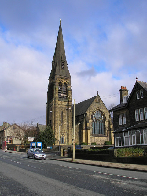
Image: © John Illingworth Taken: 24 Feb 2007
St. James's Church, Bolton, on Bolton Road, Bradford. The lamppost used to be a post supporting the wires for trolley buses, which is why it leans outward from the road. The tension in the wires would have pulled it upright. These posts are very strong and set 6' into the ground. Because of this most have not been moved but are used for lighting or carrying telephone wires or just standing there. The last trolley bus service in Britain ran in Bradford in 1972.
Images are licensed for reuse under creativecommons.org/licenses/by-sa/2.0
Image Location
Latitude
53.811909
Longitude
-1.741787