Bestwood NG5, Notts.
Introduction
The photograph on this page of Bestwood NG5, Notts. by David Hallam-Jones as part of the Geograph project.
The Geograph project started in 2005 with the aim of publishing, organising and preserving representative images for every square kilometre of Great Britain, Ireland and the Isle of Man.

There are currently over 7.5m images from over 14,400 individuals and you can help contribute to the project by visiting https://www.geograph.org.uk
Bestwood NG5, Notts.
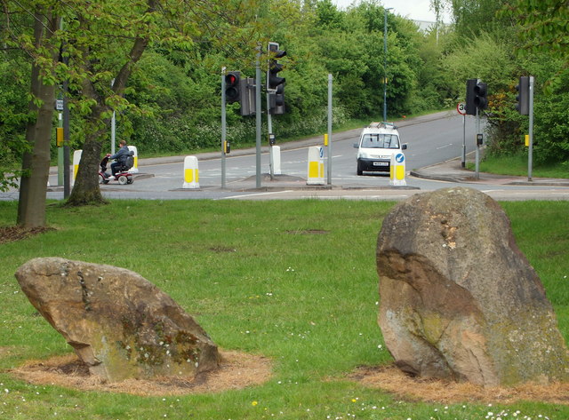
Image: © David Hallam-Jones Taken: 17 May 2013
A view of Gala Way on the opposite side of Hucknall Road (the A611) is seen here from the eastern edge of Potter's Hollow Recreation Ground. The stones are two of a linear series of similar stones that have been installed in the gaps in the tree-line of a copse that runs parallel with Hucknall Road. It seems likely that the object of the stones is to prevent 'travellers' setting up an illegal camp. Gala Road is a cul-de-sac serving a 'light industrial' zone.
Images are licensed for reuse under creativecommons.org/licenses/by-sa/2.0
Image Location
Latitude
52.998232
Longitude
-1.179569