Site of former Embleton station, 1991
Introduction
The photograph on this page of Site of former Embleton station, 1991 by Ben Brooksbank as part of the Geograph project.
The Geograph project started in 2005 with the aim of publishing, organising and preserving representative images for every square kilometre of Great Britain, Ireland and the Isle of Man.

There are currently over 7.5m images from over 14,400 individuals and you can help contribute to the project by visiting https://www.geograph.org.uk
Site of former Embleton station, 1991
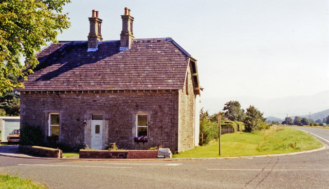
Image: © Ben Brooksbank Taken: 1 Sep 1991
View eastward on the A66 road at Lambfoot, towards Kewswick and Penrith: ex-LNW Cockermouth, Keswick & Penrith Railway. Embleton station here was closed 19/9/58 but the passenger and goods services on the line Workington - Keswick continued until 18/4/66, Keswick - Penrith 6/3/72. (It seems unlikely that the fine house remaining was the Station House, as it is angled sideways to the track-bed, which ran straight ahead).
Images are licensed for reuse under creativecommons.org/licenses/by-sa/2.0
Image Location
Latitude
54.659921
Longitude
-3.298091