Lambley NG4, Notts.
Introduction
The photograph on this page of Lambley NG4, Notts. by David Hallam-Jones as part of the Geograph project.
The Geograph project started in 2005 with the aim of publishing, organising and preserving representative images for every square kilometre of Great Britain, Ireland and the Isle of Man.

There are currently over 7.5m images from over 14,400 individuals and you can help contribute to the project by visiting https://www.geograph.org.uk
Lambley NG4, Notts.
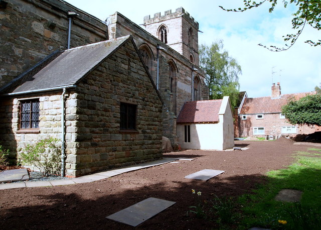
Image: © David Hallam-Jones Taken: 12 May 2013
A second extension (the furthest away) appears to have been added to the south side of the church. Church Lane and the "Top Dumble" (a.k.a "Upper Dumble") exist - at a lower level than the church - to the photographer's right (albeit not visible). The dumbles are said to be the most picturesque natural feature of the village. These are a series of small deep valleys - carrying Cocker Beck ("Crooked stream") - through into the village from the Mapperley Plains direction, i.e. the west.
Images are licensed for reuse under creativecommons.org/licenses/by-sa/2.0
Image Location
Latitude
53.002475
Longitude
-1.060573