Egremont: site of former station, 1994
Introduction
The photograph on this page of Egremont: site of former station, 1994 by Ben Brooksbank as part of the Geograph project.
The Geograph project started in 2005 with the aim of publishing, organising and preserving representative images for every square kilometre of Great Britain, Ireland and the Isle of Man.

There are currently over 7.5m images from over 14,400 individuals and you can help contribute to the project by visiting https://www.geograph.org.uk
Egremont: site of former station, 1994
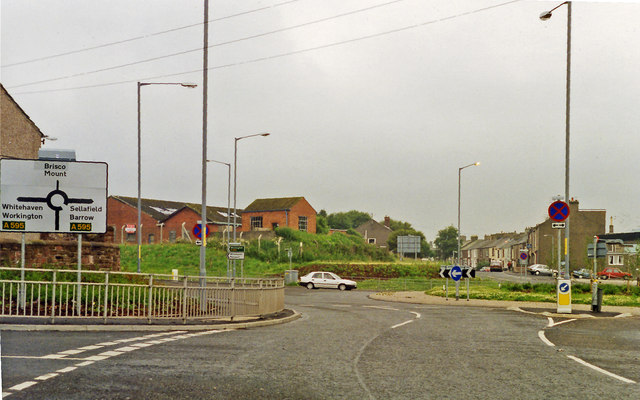
Image: © Ben Brooksbank Taken: 4 Jul 1994
View NE at the roundabout on the A595 Barrow- Whitehaven road. The station had been just up to the left here: ex-LNW & Furness Joint, Whitehaven, Cleator & Egremont line; Moor Row (to left) - Sellafield (to right). The station (and line) had a complex history, being first closed to passengers 7/1/35, but reopened for workmen 11/3/40, for the public 6/5/46 - 16/6/47, but again for workmen 23/5/49 - 6/9/65, for schools 3/3/69. It and the line remained for goods until 15/6/72. (!)
Images are licensed for reuse under creativecommons.org/licenses/by-sa/2.0
Image Location
Latitude
54.485016
Longitude
-3.529187